Interactive map of protected areas for the Tyrolean Nature Parks
- Topic area
- Environment, biodiversity, nature conservation
- Innovation
- Disaggregation level
- Tourism
- Protected areas
- Interregional/Transnational cooperation projects
- Knowledge transfer
- Innovation
- Project region
- Tyrol
- LE– Programming Period
- LE 14–20
- Project period
- 1.1.2016-31.12.2016
- Project costs overall
- 36021
- Subsidy from LE 14-20
- 36021
- Priority
- EN - 16.05.2. a) Stärkung der Zusammenarbeit von AkteurInnen und Strukturen zur Erhaltung des natürlichen Erbes & des Umweltschutzes - Naturschutz
- Project initiator
- Naturpark Kaunergrat (Pitztal-Fließ-Kaunertal)
Short description
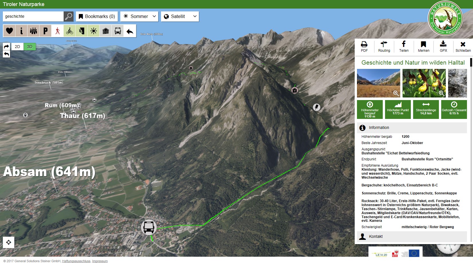
The management of protected areas in Tyrol's nature parks is based on the implementation of various measures related to nature conservation, recreation and tourism, regional development, environmental education as well as related to research. The Tyrolean nature parks can present a comprehensive set of achievements on the above-mentioned “pillars”.The current cooperation project had the aim to create a common interactive digital map of protected areas. For this, the programming of an overview-application and a so-called WEBGIS application was established for each park. Both applications have been made available for the purpose of the management of protected areas. The application is expected to improve the communication of the wide range of static and dynamic information from the individual fields relevant for the management of protected areas to the qualified and interested public.
Point of departure
- Increase the quality of visitor guidance- Foster synergies with other organisations (tourism associations, NGOs, municipalities, etc.)
Targets and target groups
- Nature parks – exchange- Interested/ qualified public
Project implementation and measures
The basis for this project is the joint determination of the data to be mapped (point, line and area data) across the various nature parks. Based on the defined data a functional specification booklet for the executing company is created. In this context, the required interfaces are specified as well.Results and effects
- Visualisation of information and contents from natural history in cartographic and descriptive form. - Visualisation of the relevant content on nature parks for a functioning visitor guidance system (from arrival to stay on site).
- The application can be displayed on PCs and tablets with intact Internet connection.
- Existing data from the “GDI Data Pool Tyrol” is integrated into the application.
- Newly created content is stored centrally in the Tyrol Geodata Pool, in order to facilitate the dissemination of cross-cutting topics and content among important partner organisations.
Erfahrung
Through the interactive map of protected areas the knowledge that is being generated in terms of nature protection can be communicated to the interested public more efficiently. In addition, a platform on regional knowledge will be established on the long term introducing various benefits (source for all kind of planning tasks, environmental education) for different actors.The communication of data and information about nature and the active control of visitors via internet brings the topic of nature protection again closer to the land users (regional stakeholders as well as tourists and guests). Furthermore, the dynamic and interactive communication through a map of protected areas brings the advantage that information is spatially located and any modifications within the database can be immediately be updated.